| ||
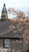
Scout ScarJust south of the Lake District National Park, Scout Scar is an easy walk which, rewards with panoramic views of the Lyth Valley and the Lake District southern hills.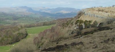 Approximately seven miles from Junction 36 of the M6, making this an ideal walk if you are looking for a half-day filler whilst waiting for your self-catering cottage to become available, or as a last walk in Cumbria before beginning your journey home. How to get to Scout ScarThe best approach is starting from Helsington Church (grid ref. SD489889) which sits on the Southern end of the escarpment that forms Scout Scar.To find the church head out of Kendal on the road to Brigsteer, after about 2.5 miles the road descends sharply at the top of the escarpment, the unusually flat-bottomed Lyth Valley comes in to view (flat because its reclaimed land) and the road turns sharp right down to Brigsteer. On this sharp right corner there is a turning left, take this to the church which is visible just a few hundred yards away. Scout Scar WalkHarry Griffin - The GuardianThis (Scout Scar) must surely be one of the finest viewpoints in England, for you can see at least 120 hills and mountains in the Lake District, Yorkshire and Lancashire from it, as well as less interesting features such as Blackpool Tower, far away across Morecambe Bay.Read more of his article and interesting nugget of how he added the Griffin Step. Park near St. John's church and walk northwards, back to the Brigsteer road, at the road turn right towards Kendal and look out for a gate on the left after just 50 yards or so.
The path along the scar stays mostly quite close to the edge offering continuous views of the lake district and its southern foothills. Go through the stone wall and on to another wall where you will see the track bears right alongside the wall. At the end of the wall cross over the ditch and then follow the foot-path to the gap at the top of the scar.
From here there are several paths, some cut by sheep, others by walkers. I would recommend staying close to the escarpment to ease navigation. Keep going north for about 1.5 - 2 miles until the viewpoint shelter is eventually reached.
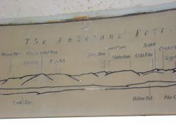
Etched inside the inner rim of the dome is a 360 degree panorama of the surrounding fells and peaks. For the return leg you can either just retrace your steps back to Helsington Church or heading back south and keeping to the edge of the scar, look for the small dip in the escarpment which is the path down to Barrowfield Farm. This path down is about 1 mile from the mushroom and is easy to miss, so this is where you need to follow the edge closely. The path heads down from Scout Scar through trees to the Barrowfields Farm. The foot-path leads you around the left side of the farm before turning left on to the farm track. Follow the farm track all the way to the road (You are now just further down the road you turned off to park by Helsington Church). At this point you can choose to head directly back to your car up the hill or, if you are in need of refreshment and can face the walk back up....to the Wheatsheaf at the bottom of the hill. An alternate and pleasant route though, is to head down the hill and after just 100 yards, turn a very sharp left along another rough track.
|
Self Catering Cottages near Scout Scar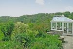 A hand chosen selection of cottages in the Lyth Valley, Winster and Crosthwaite area Looking for a child friendly coffee shop? Lower Sizergh Barn* has a lovely little tea room with a window over-looking the milking parlour - if you are lucky you may get to see the cows being milked!
Read morehere. *Lower Sizergh Barn is about 2.7 miles south of Brigsteer on the A591 |
|
|
| ||
| Return to top of Scout Scar
By using the Discover Cumbria website you acknowledge that you are familiar with and agree to abide by the Discover Cumbria privacy policies and disclaimer policy.
Cottages advertised on this site : Please ensure that you check all details directly with the cottage lease company prior to booking.
|Disclaimer | Privacy Policy |Contact Discover Cumbria | About Us
Copyright© 2008 - 2018
|
||
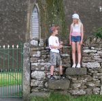 Go through the gate and follow the well-trodden grassy track northwards along the edge of Helsington Barrows.